
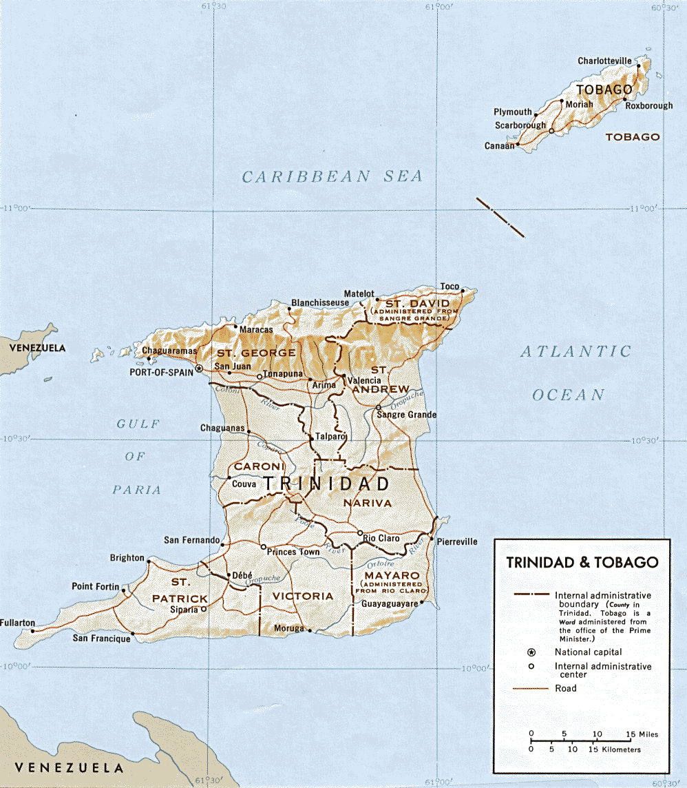
File:Trinidad and Tobago map.png
Size of this preview: 523 × 600 pixels. Other resolutions: 209 × 240 pixels | 419 × 480 pixels | 998 × 1,144 pixels.
Original file (998 × 1,144 pixels, file size: 213 KB, MIME type: image/png)
| This is a file from the Wikimedia Commons. Information from its description page there is shown below. Commons is a freely licensed media file repository. You can help. |
| Description | Map of Trinidad and Tobago | |||
| Date | ||||
| Source | http://www.lib.utexas.edu/maps/americas.html | |||
| Author | CIA | |||
| Permission (Reusing this file) |
|
|||
| Other versions | Derivative works of this file: Range of Poecilia obscura.png |

File history
Click on a date/time to view the file as it appeared at that time.
| Date/Time | Thumbnail | Dimensions | User | Comment | |
|---|---|---|---|---|---|
| current | 02:23, 17 March 2009 | | 998 × 1,144 (213 KB) | Sasha Krotov | {{Information |Description=Map of Trinidad and Tobago |Source=http://www.lib.utexas.edu/maps/americas.html |Date=1969 |Author=CIA |Permission={{PD-USGov-CIA}} |other_versions= }} Category:Maps of Trinidad and Tobago <!--{{ImageUpload|basic}}--> |
File usage
The following 2 pages use this file:
Global file usage
The following other wikis use this file:
- Usage on fr.wikipedia.org