
File:Provincia de Guayana Cantón Piacoa.JPG

Size of this preview: 779 × 599 pixels. Other resolutions: 312 × 240 pixels | 624 × 480 pixels | 998 × 768 pixels | 1,280 × 985 pixels | 1,353 × 1,041 pixels.
Original file (1,353 × 1,041 pixels, file size: 321 KB, MIME type: image/jpeg)
| This is a file from the Wikimedia Commons. Information from its description page there is shown below. Commons is a freely licensed media file repository. You can help. |
Summary
| Description |
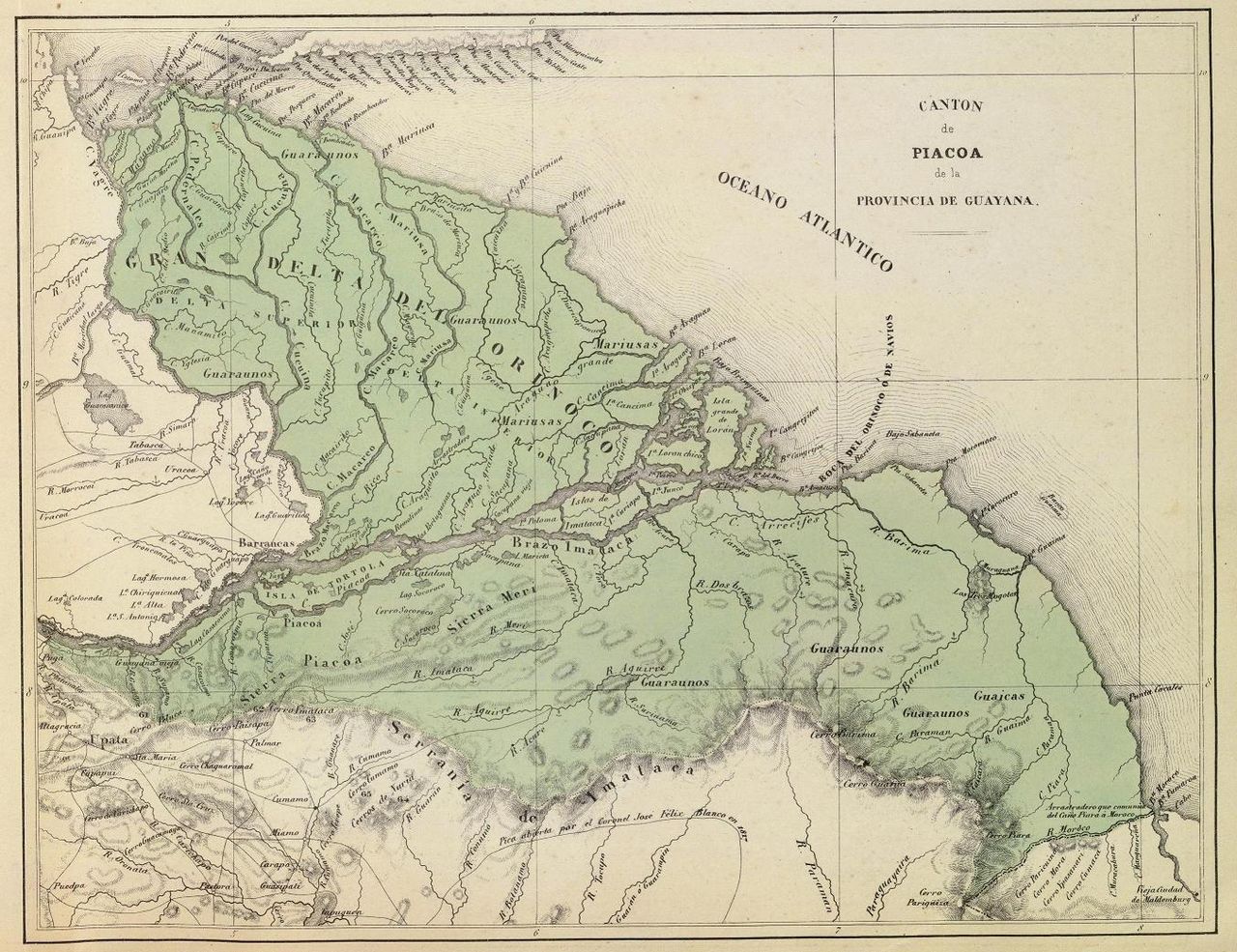
Español: Cantón Piacoa de la Provincia de Guayana. Tomado del "Atlas físico y político de la República de Venezuela", 1840. |
||||||||||||||||||||
| Date | |||||||||||||||||||||
| Source | Historical Maps by Agustín Codazzi, from David Rumsey Website | ||||||||||||||||||||
| Author |
|
||||||||||||||||||||

Licensing
|
This work is in the public domain in its country of origin and other countries and areas where the copyright term is the author's life plus 70 years or fewer. | |
| This file has been identified as being free of known restrictions under copyright law, including all related and neighboring rights. | |
File history
Click on a date/time to view the file as it appeared at that time.
| Date/Time | Thumbnail | Dimensions | User | Comment | |
|---|---|---|---|---|---|
| current | 04:32, 17 March 2009 | | 1,353 × 1,041 (321 KB) | Milenioscuro | {{Information |Description={{es|1=Cantón Piacoa de la Provincia de Guayana. Tomado del "Atlas físico y político de la República de Venezuela", 1840.}} |Source=[http://www.davidrumsey.com/directory/who/Codazzi++Agustin++1793+1859/ Historical Maps by Ag |
File usage
The following 2 pages use this file:
Global file usage
The following other wikis use this file:
- Usage on da.wikipedia.org
- Usage on de.wikipedia.org
- Usage on es.wikipedia.org
- Usage on fr.wikipedia.org
- Usage on gl.wikipedia.org
- Usage on hr.wikipedia.org
- Usage on tr.wikipedia.org
- Usage on uk.wikipedia.org