
File:Mapa de Mexico 1845.PNG
Size of this preview: 674 × 600 pixels. Other resolutions: 270 × 240 pixels | 540 × 480 pixels | 863 × 768 pixels | 1,151 × 1,024 pixels | 1,478 × 1,315 pixels.
Original file (1,478 × 1,315 pixels, file size: 96 KB, MIME type: image/png)
| This is a file from the Wikimedia Commons. Information from its description page there is shown below. Commons is a freely licensed media file repository. You can help. |
Summary
| Description |
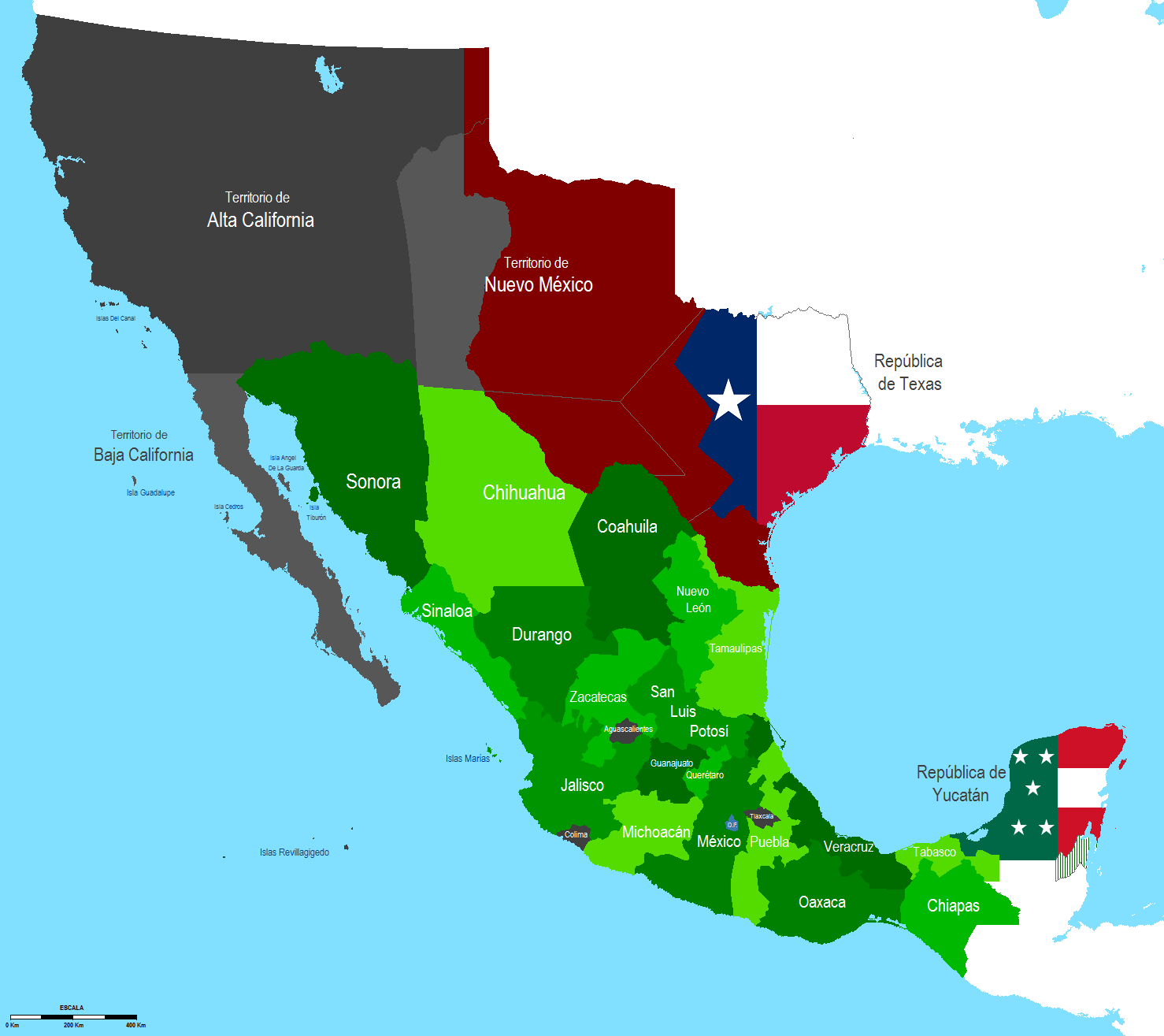
English: Map of Mexico 1845
Español: Mapa de Mexico en 1845 |
| Source | Own work |
| Author | Jaimiko |
Licensing
| I, the copyright holder of this work, release this work into the public domain. This applies worldwide. In some countries this may not be legally possible; if so: I grant anyone the right to use this work for any purpose, without any conditions, unless such conditions are required by law. |
File history
Click on a date/time to view the file as it appeared at that time.
| Date/Time | Thumbnail | Dimensions | User | Comment | |
|---|---|---|---|---|---|
| current | 07:27, 21 September 2011 | | 1,478 × 1,315 (96 KB) | Hpav7 | ajustes |
| 02:25, 2 March 2011 |  | 1,478 × 1,315 (96 KB) | Hpav7 | Correccion de Margenes | |
| 07:53, 28 January 2010 |  | 1,478 × 1,315 (96 KB) | Jaimiko | {{Information |Description={{en|1=Map of Mexico 1845}} {{es|1=Mapa de Mexico en 1845}} |Source={{own}} |Author=Jaimiko |Date= |Permission= |other_versions= }} Category:Maps of Mexico |
File usage
The following pages on the English Wikipedia use this file (pages on other projects are not listed):
Global file usage
The following other wikis use this file:
- Usage on ca.wikipedia.org
- Usage on es.wikipedia.org
- Usage on fa.wikipedia.org
- Usage on he.wikipedia.org
- Usage on hr.wikipedia.org
- Usage on it.wikipedia.org
- Usage on pt.wikipedia.org
- Usage on sh.wikipedia.org