
File:Kingdom of Bohemia during the Hussite Wars.jpg
Size of this preview: 800 × 598 pixels. Other resolutions: 320 × 239 pixels | 640 × 479 pixels | 1,024 × 766 pixels | 1,151 × 861 pixels.
Original file (1,151 × 861 pixels, file size: 468 KB, MIME type: image/jpeg)
| This is a file from the Wikimedia Commons. Information from its description page there is shown below. Commons is a freely licensed media file repository. You can help. |
Summary
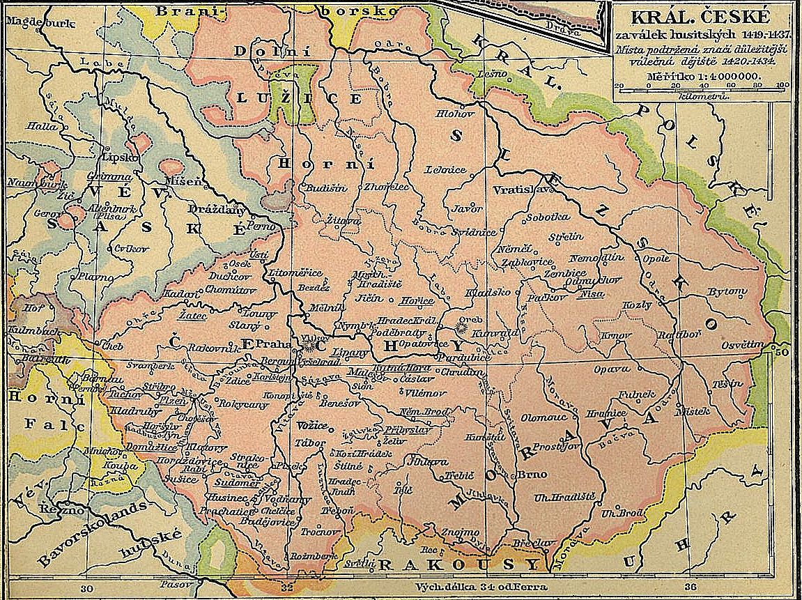
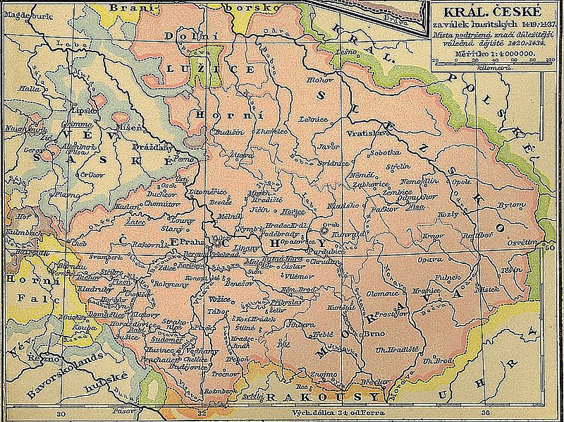
| Description | Map of the Kingdom of Bohemia (the area in pink) at the time of the Hussite Wars. The descriptions are in Czech. |
| Date | (unamended reprint of the original first published in 1898) |
| Source | Historický školní atlas by F. W. Putzger, published by the widow and son of A. Pichler in Vienna |
| Author | Alfred Baldamus, Arnošt Schwab and Vavřinec Josef Dusek |
Licensing
|
This is a faithful photographic reproduction of a two-dimensional, public domain work of art. The work of art itself is in the public domain for the following reason:
The official position taken by the Wikimedia Foundation is that "faithful reproductions of two-dimensional public domain works of art are public domain". This photographic reproduction is therefore also considered to be in the public domain in the United States. In other jurisdictions, re-use of this content may be restricted; see Reuse of PD-Art photographs for details. {{PD-Art}} template without license parameter: please specify why the underlying work is public domain in both the source country and the United States
(Usage: {{PD-Art|1=|deathyear=''year of author's death''|country=''source country''}}, where parameter 1= can be PD-old-auto, PD-old-auto-expired, PD-old-auto-1996, PD-old-100 or similar. See Commons:Multi-license copyright tags for more information.) | ||||
Na Zikmundovo naléhání byl proto svolán kostnický koncil, který měl vyřešit problém Na Zikmundovo naléhání byl proto svolán kostnický koncil, který měl vyřešit problém trojpapežství.trojpapežství.
File history
Click on a date/time to view the file as it appeared at that time.
| Date/Time | Thumbnail | Dimensions | User | Comment | |
|---|---|---|---|---|---|
| current | 20:29, 26 March 2008 | | 1,151 × 861 (468 KB) | Geographus | {{Information |Description= Map of the Kingdom of Bohemia (the area in pink) at the time of the Hussite Wars. The descriptions are in Czech. |Source= Historický školní atlas by F. W. Putzger, published by the widow and son of A. Pichler in Vienna |Dat |
File usage
The following page uses this file:
Global file usage
The following other wikis use this file:
- Usage on af.wikipedia.org
- Usage on an.wikipedia.org
- Usage on az.wikipedia.org
- Usage on be.wikipedia.org
- Usage on ca.wikipedia.org
- Usage on cs.wikipedia.org
- Usage on de.wikipedia.org
- Usage on dsb.wikipedia.org
- Usage on el.wikipedia.org
- Usage on eu.wikipedia.org
- Usage on fi.wikipedia.org
- Usage on fr.wikipedia.org
- Usage on hu.wikipedia.org
- Usage on hy.wikipedia.org
- Usage on it.wikipedia.org
- Usage on ka.wikipedia.org
- Usage on lv.wikipedia.org
- Usage on mr.wikipedia.org
- Usage on pl.wikipedia.org
- Usage on ps.wikipedia.org
- Usage on pt.wikipedia.org
- Usage on ru.wikipedia.org
- Usage on sk.wikipedia.org
- Usage on sr.wikipedia.org
- Usage on uk.wikipedia.org