
File:Greek Macedonia map with subdivisions.svg

Size of this PNG preview of this SVG file: 599 × 600 pixels. Other resolutions: 240 × 240 pixels | 479 × 480 pixels | 767 × 768 pixels | 1,023 × 1,024 pixels | 2,045 × 2,048 pixels | 736 × 737 pixels.
Original file (SVG file, nominally 736 × 737 pixels, file size: 1.78 MB)
| This is a file from the Wikimedia Commons. Information from its description page there is shown below. Commons is a freely licensed media file repository. You can help. |
| Description |
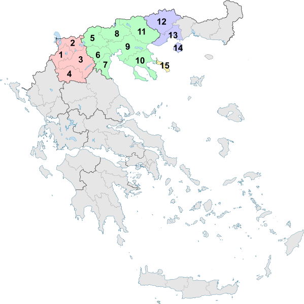
English: The Greek region of Macedonia, and its subdivisions into Peripheries and Peripheral Units as of 2011. |
| Date | (UTC) |
| Source | |
| Author |
|
| Other versions |
Derivative works of this file: |
I, the copyright holder of this work, hereby publish it under the following license:
This file is licensed under the Creative Commons Attribution-Share Alike 3.0 Unported license.
- You are free:
- to share – to copy, distribute and transmit the work
- to remix – to adapt the work
- Under the following conditions:
- attribution – You must give appropriate credit, provide a link to the license, and indicate if changes were made. You may do so in any reasonable manner, but not in any way that suggests the licensor endorses you or your use.
- share alike – If you remix, transform, or build upon the material, you must distribute your contributions under the same or compatible license as the original.
Uploaded with derivativeFX
File history
Click on a date/time to view the file as it appeared at that time.
| Date/Time | Thumbnail | Dimensions | User | Comment | |
|---|---|---|---|---|---|
| current | 14:24, 10 February 2019 | | 736 × 737 (1.78 MB) | Sarah fides | Hopefully this fixes the annoying black line that keeps appearing off the Ionian islands |
| 14:21, 10 February 2019 |  | 736 × 737 (1.79 MB) | Sarah fides | Cleanup | |
| 22:25, 27 July 2011 |  | 7,304 × 7,315 (1.79 MB) | Sarah fides | {{Information |Description={{en|1=The Greek region of Macedonia, and its subdivisions into Peripheries and Peripheral Units as of 2011.}} |Source=*File:Greece_2011_Periferiakes_Enotites.svg |Date=2011-07-27 22:23 (UTC) |Author=*[[:File:Greece_2011_P |
File usage
The following page uses this file:
Global file usage
The following other wikis use this file:
- Usage on de.wikipedia.org
- Usage on el.wikipedia.org
- Usage on el.wikivoyage.org
- Usage on et.wikipedia.org
- Usage on fi.wikipedia.org
- Usage on fr.wikivoyage.org
- Usage on hr.wikipedia.org
- Usage on lt.wikipedia.org
- Usage on nn.wikipedia.org
- Usage on vi.wikipedia.org