
File:Greater Accra districts.png

Size of this preview: 800 × 560 pixels. Other resolutions: 320 × 224 pixels | 640 × 448 pixels | 995 × 696 pixels.
Original file (995 × 696 pixels, file size: 14 KB, MIME type: image/png)
| This is a file from the Wikimedia Commons. Information from its description page there is shown below. Commons is a freely licensed media file repository. You can help. |
Summary
| Description |
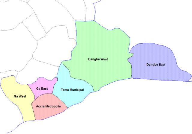
English: Map of the districts of the Greater Accra region of Ghana. Created by Rarelibra for public domain use. Created using MapInfo Professional v7.5 and various mapping resources. |
||
| Date | 28 June 2006 (original upload date) | ||
| Source | Own work | ||
| Author | User:Rarelibra | ||
| Other versions |
|

Licensing
| I, the copyright holder of this work, release this work into the public domain. This applies worldwide. In some countries this may not be legally possible; if so: I grant anyone the right to use this work for any purpose, without any conditions, unless such conditions are required by law. |
Original upload log
- (del) (cur) 07:36, 5 March 2006 . . Rarelibra (Talk | contribs) . . 1056x816 (29,321 bytes) (Map of the districts of the Greater Accra region of Ghana. Created by Rarelibra for public domain use. Created using MapInfo Professional v7.5 and various mapping resources.)
File history
Click on a date/time to view the file as it appeared at that time.
| Date/Time | Thumbnail | Dimensions | User | Comment | |
|---|---|---|---|---|---|
| current | 14:00, 6 January 2021 | | 995 × 696 (14 KB) | Jakob Gottfried | cropped |
| 10:52, 28 June 2006 |  | 1,056 × 816 (29 KB) | Ahanta | from:en:Districts of ghana Map of the districts of the Greater Accra region of Ghana. Created by Rarelibra for public domain use. Created using MapInfo Professional v7.5 and various mapping resources. [edit] I, the creator of this work, hereby release it |
File usage
The following 4 pages use this file:
Global file usage
The following other wikis use this file:
- Usage on ceb.wikipedia.org
- Usage on cs.wikipedia.org
- Usage on dag.wikipedia.org
- Usage on de.wikipedia.org
- Usage on es.wikipedia.org
- Usage on fr.wikipedia.org
- Usage on gpe.wikipedia.org
- Usage on ha.wikipedia.org
- Usage on it.wikipedia.org
- Usage on ko.wikipedia.org
- Usage on nl.wikipedia.org
- Usage on pl.wikipedia.org
- Usage on pt.wikipedia.org
- Usage on ro.wikipedia.org
- Usage on tr.wikipedia.org
- Usage on tw.wikipedia.org
- Usage on uk.wikipedia.org
- Usage on www.wikidata.org
- Usage on yo.wikipedia.org
- Usage on zu.wikipedia.org