
File:Canada provinces 1905-1912.png
Size of this preview: 694 × 600 pixels. Other resolutions: 278 × 240 pixels | 556 × 480 pixels | 1,000 × 864 pixels.
Original file (1,000 × 864 pixels, file size: 63 KB, MIME type: image/png)
| This is a file from the Wikimedia Commons. Information from its description page there is shown below. Commons is a freely licensed media file repository. You can help. |
File history
Click on a date/time to view the file as it appeared at that time.
| Date/Time | Thumbnail | Dimensions | User | Comment | |
|---|---|---|---|---|---|
| current | 17:22, 14 July 2009 | | 1,000 × 864 (63 KB) | Golbez | New color scheme, other borders |
| 09:59, 7 August 2006 |  | 1,000 × 864 (50 KB) | Golbez | with legend | |
| 02:24, 18 February 2006 |  | 1,000 × 864 (49 KB) | Golbez | Better version | |
| 23:49, 13 February 2006 |  | 1,000 × 864 (43 KB) | Golbez | better colors | |
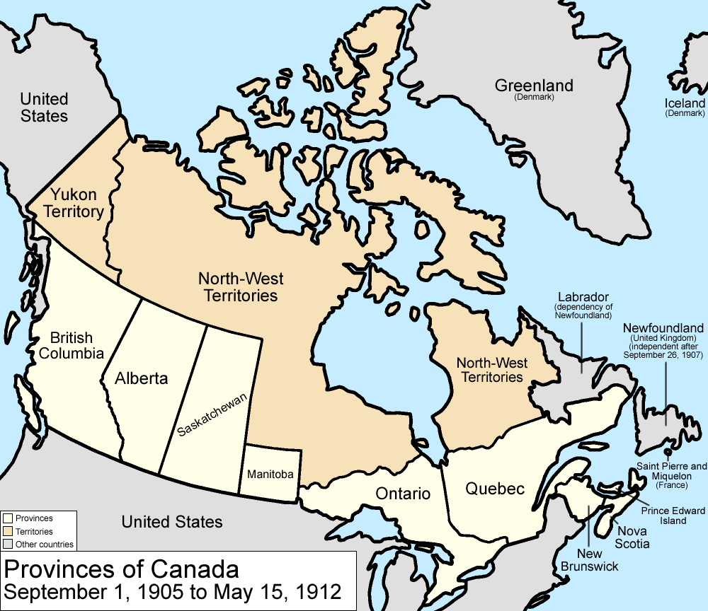
| 07:14, 13 February 2006 |  | 1,000 × 864 (42 KB) | Golbez | Map of the provinces and territories of Canada as they were between 1905 and 1912. On September 1 1905, Alberta and Saskatchewan were created from parts of the North-West Territories. On May 15 1912, parts of the North-West Territories were given to Manit |
File usage
The following 5 pages use this file:
Global file usage
The following other wikis use this file:
- Usage on arz.wikipedia.org
- Usage on ast.wikipedia.org
- Usage on de.wikipedia.org
- Usage on es.wikipedia.org
- Usage on fr.wikipedia.org
- Usage on fy.wikipedia.org
- Usage on gl.wikipedia.org
- Usage on it.wikipedia.org
- Usage on no.wikipedia.org
- Usage on pt.wikipedia.org
- Usage on ru.wikipedia.org
- Usage on sv.wikipedia.org
- Usage on uk.wikipedia.org
- Usage on vi.wikipedia.org
- Usage on www.wikidata.org
- Usage on zh.wikipedia.org